
Verified Image & Video Annotation for Safety-Critical AI
Transform raw image and video datasets into structured, model-ready training data with scalable, high-accuracy data annotation services.


PERSON
RUNNER
VEHICLE
CAT
Comprehensive Data Annotation Services for Computer Vision
Intellabel provides precise Data labeling services designed to support computer vision model development across various industries. Our annotation teams handle complex datasets while maintaining consistent labeling standards.

Bounding Box Annotation
Identify and label objects such as vehicles, people, or products.

Polygon Annotation
Capture pixelwise object boundaries for detailed object detection.

Semantic Segmentation
Pixel-level labeling for scene understanding and classification.
Instance Segmentation
Differentiate multiple objects belonging to the same category.

Keypoint Annotation
Annotate landmarks for pose estimation and motion tracking.

Image Classification
Assign category labels to images for recognition models.
Annotation Services Across Industries
PEDESTRIAN
CAR
CAR
LIGHT
SIGN
Lane detection, pedestrian tracking, vehicle detection, and drivable area segmentation.

CEREAL
SODA
SNACK
MILK
YOGURT
CHOCOLATE
CEREAL: 12
SODA: 20
SNACK: 8
MILK: 15
Shelf monitoring, product detection, SKU recognition, and customer behavior analysis.

BRAIN
SPINE
LUNG
TUMOR
⚠ BRAIN LESION DETECTED
✖ PULMONARY TUMOR DETECTED
Medical image annotation including fetal anatomy, X-rays, and diagnostic imaging datasets.

HEALTHY CROP
DISEASED PLANT
PEST
🌱 Crop Health: 92%
💧 Water Level ↓
Crop detection, weed identification, and plant health monitoring using annotated datasets.

PERSON
PERSON
CAR
SUSPICIOUS BAG
WEAPON
⚠ Suspicious Object Detected
✖ Weapon Detected
Object tracking, threat detection, and crowd analysis for surveillance systems.

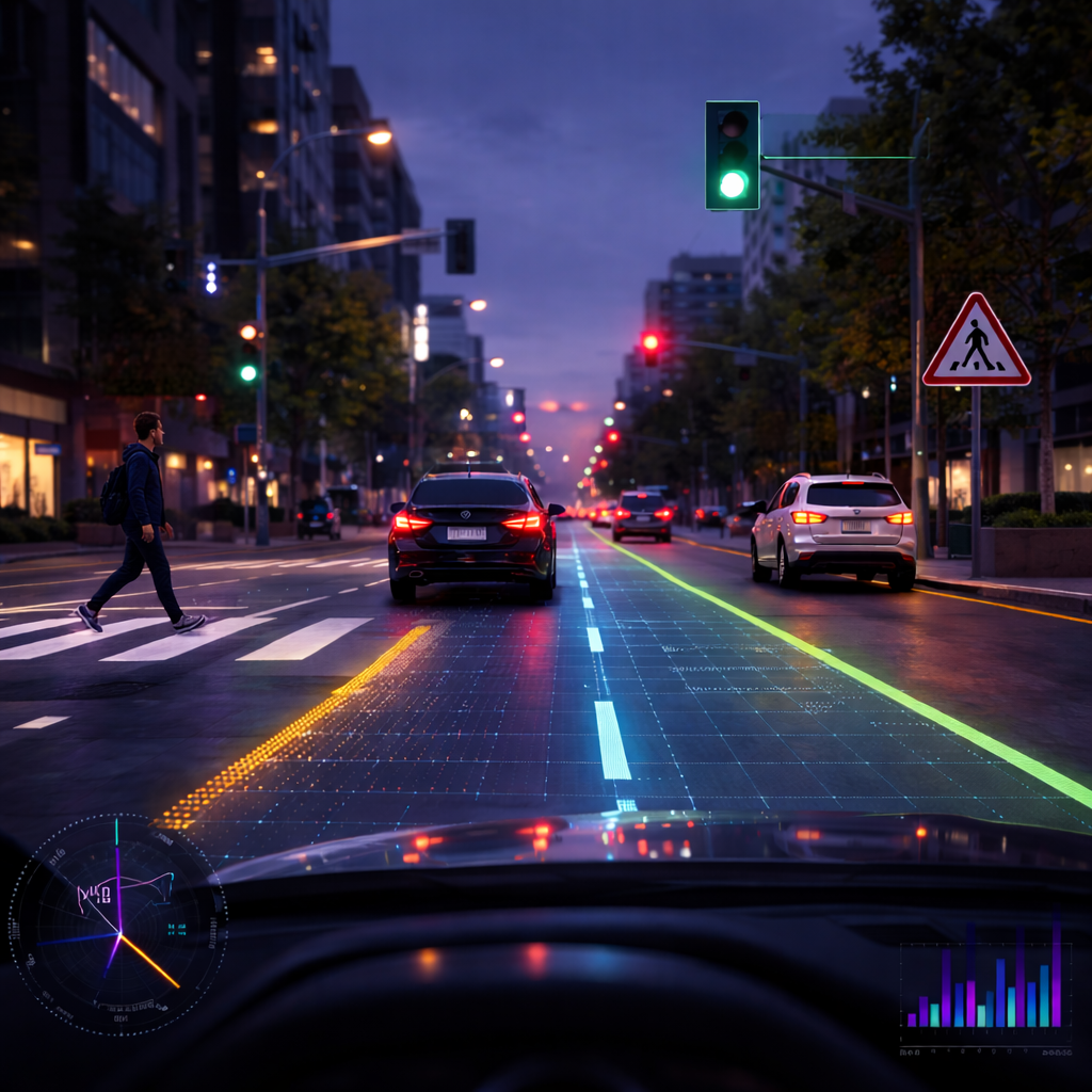
TRAFFIC CONGESTION
ACCIDENT
MISPLACED DEBRIS
⬇ Traffic Incident Detected
⚠ Signal Failure Detected
Traffic monitoring, parking analysis, and infrastructure intelligence.
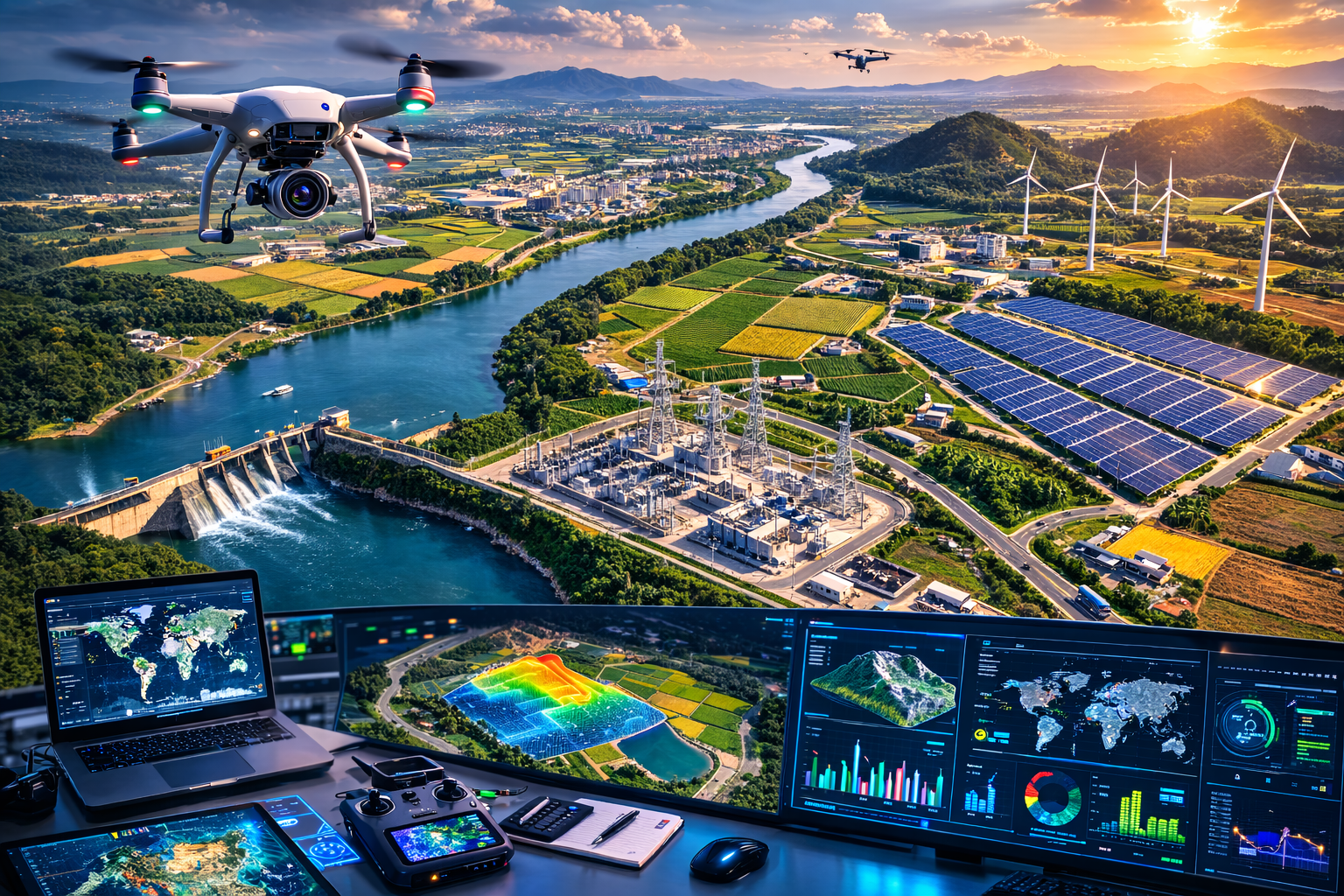
FARMLAND
WIND TURBINE
SOLAR FARM
POWER SUBSTATION
DAM
Drone imagery annotation for forestry, solar inspection, and land monitoring.

DENSE FOREST
CROPLAND
URBAN AREA
CLOUD / WATER
🌍 Land Mapping Active
📡 Satellite Scan Running
Satellite image annotation for land mapping, vegetation tracking, and object detection.
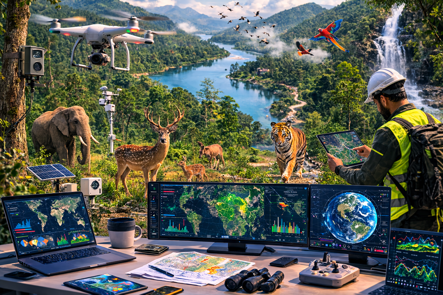
DEER
TIGER
BIRD TRACKING
CAMERA TRAP
SENSOR STATION
DRONE SURVEILLANCE
🌲 Forest Monitoring Active
📡 Wildlife Tracking Enabled
Wildlife tracking, forest monitoring, and environmental change detection.

VISUAL INSPECTION
QUALITY INSPECTION
DEFECT DETECTED
AUTOMATION ARM
⚙ Quality Control Active
⚠ Defect Identification Running
Defect detection, quality inspection, and automation workflows for production lines.
How Our Annotation Process Works
Scope & Sample Review
Define annotation requirements, share labeling guidelines, and review sample data with our team for accuracy benchmarks.


Proof of Concept + Quote
Run a small POC on a representative slice of your data. Receive a fixed quote with throughput and timeline estimates.
Production Annotation
Expert annotators label your data at scale with AI-assisted tools, working from the approved guidelines.
Multi-Layer QA & Delivery
Multi-stage QA, immutable audit logs, and delivery in your preferred format — model-ready, traceable, and audit-defensible.

One platform to turn raw data into production-ready AI: combining data annotation, dataset management, and machine learning workflows in a single system.
Address: WeWork, Salarpuria Symbiosis, Bannerghatta Rd, Bengaluru, Karnataka

.png)